


The South African Weather Service has issued multiple severe weather warnings for Tuesday, 5 May 2026, as an intense cut-off low system brings heavy rain, flooding, strong winds and snow across several provinces.
The highest alert, an Orange Level 8 warning, is in place for parts of the Eastern Cape, with dangerous flooding expected.
ALSO READ: Cold front warning: heavy rain, flooding and snow to hit parts of South Africa
Where severe weather is hitting today
- Eastern Cape: Highest risk with flooding and danger to life
- KwaZulu-Natal: Severe thunderstorms with damaging winds and hail
- Western Cape: Heavy rain, flooding and possible snow
- Gauteng and central regions: Thunderstorms and localised flooding
- Northern Cape: Cold conditions with snow expected in high areas
The system is expected to continue into Wednesday and Thursday.
Eastern Cape faces highest risk
The most severe conditions are expected in the Eastern Cape.
An Orange Level 8 warning is in place for Koukamma and Kouga, where:
- Flooding of homes and roads is expected
- Communities may be cut off
- There is a real danger to life
An additional Orange Level 6 warning covers coastal areas from Tsitsikamma to Kei Mouth, with ongoing heavy rain and flooding.
KwaZulu-Natal braces for severe storms
KwaZulu-Natal is under multiple warnings for severe thunderstorms.
Expect:
- Strong damaging winds
- Large hail
- Heavy downpours
- Flooding of roads and settlements
Both Orange Level 6 and Yellow Level 4 warnings are active across the province.
Western Cape hit by rain, wind and snow
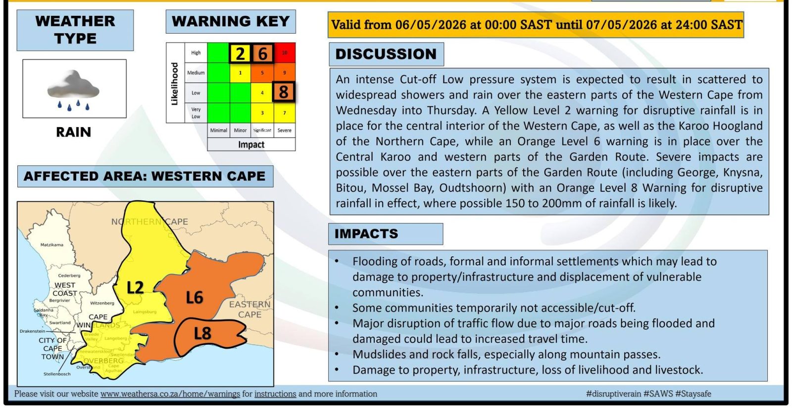
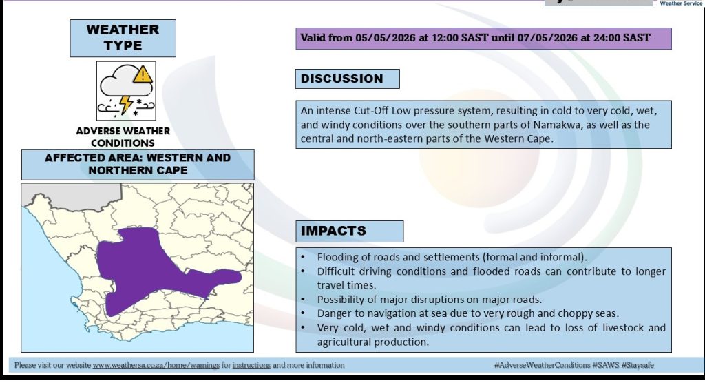
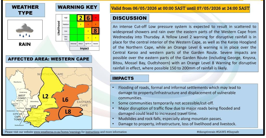
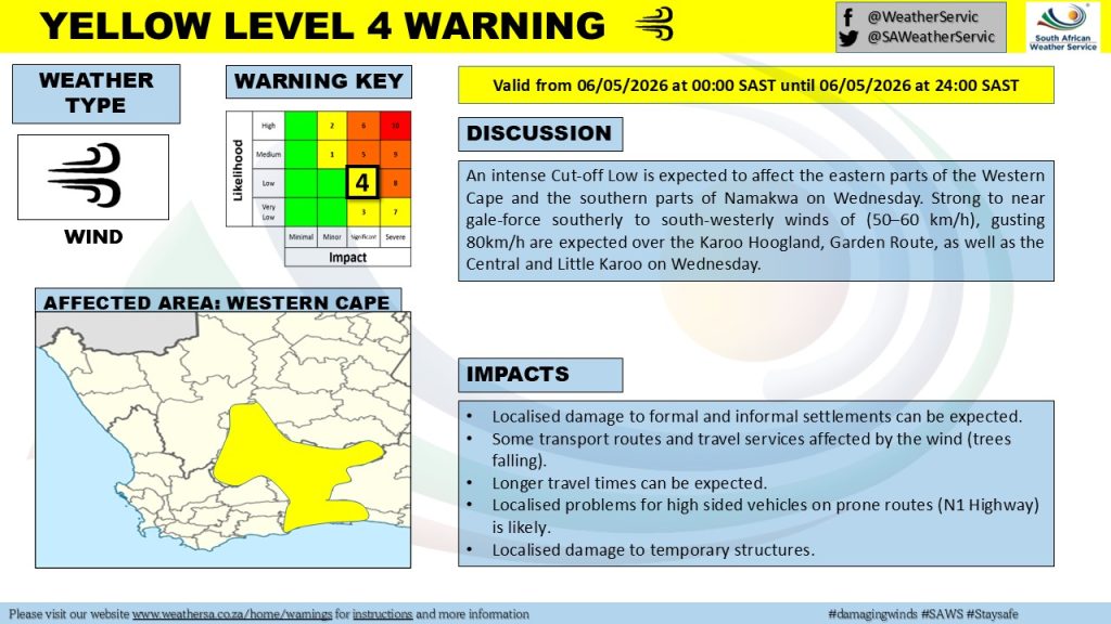
Parts of the Western Cape are already seeing disruptive rain, with more severe weather expected into midweek.
Warnings include:
- Flooding in the Garden Route and Central Karoo
- Gale-force winds along the coast
- Rough seas and storm surge risks
- Snowfall in high-lying areas
Conditions are expected to worsen between Wednesday and Thursday.
Gauteng and inland provinces see thunderstorms
A Yellow Level 2 warning is in place for Gauteng, the Free State, North West, Limpopo and Mpumalanga.
These regions can expect:
- Widespread showers and thunderstorms
- Localised flooding in low-lying areas
- Possible damage to infrastructure
Snowfall expected in multiple regions
Snow is forecast for:
- Northern Cape high ground
- Western Cape mountains
- Eastern Cape high-lying areas
This could lead to:
- Slippery roads
- Travel disruptions
- Risk to livestock in rural areas
What to expect over the next few days
The cut-off low system will continue affecting large parts of the country until Thursday.
Weather risks include:
- Heavy rainfall and flooding
- Strong winds and coastal damage
- Very cold conditions
- Snow in elevated areas
The combination of these factors increases the risk of disruption across multiple provinces.
Safety advice for residents
- Avoid flooded roads and low-lying areas
- Delay travel in high-risk regions
- Secure outdoor items ahead of strong winds
- Monitor official updates from SAWS
- Farmers should protect livestock from cold and wet conditions
Why this matters
Severe weather systems like this can escalate quickly and affect both urban and rural communities.
Flooding, strong winds and snow not only disrupt daily life but can also damage infrastructure and pose serious safety risks.





Related Articles

Mpho Popps to Host 2026 Content Creator Awards
Mpho “Popps” Modikoane will host the 2026 Content Creator Awards, bringing his...

Rassie Names Springbok Team to face All Blacks
Rassie Erasmus has named his Springbok team for the opening Rugby’s Greatest...

Volkswagen Opens Pre-Orders for New T-Roc in South Africa
Volkswagen has opened pre-orders for the second-generation T-Roc ahead of its South...



European Film Festival SA Returns With 12 Acclaimed Films
The European Film Festival South Africa returns for its 13th edition from...
