


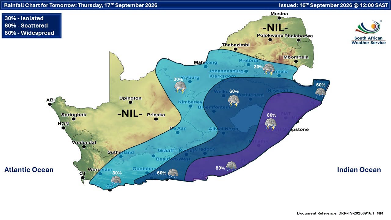
South Africans are being warned to prepare for dangerous weather, with an Orange Level 6 warning for disruptive rain in KwaZulu-Natal and severe thunderstorms, damaging winds, bitterly cold conditions and possible snowfall forecast across several provinces.
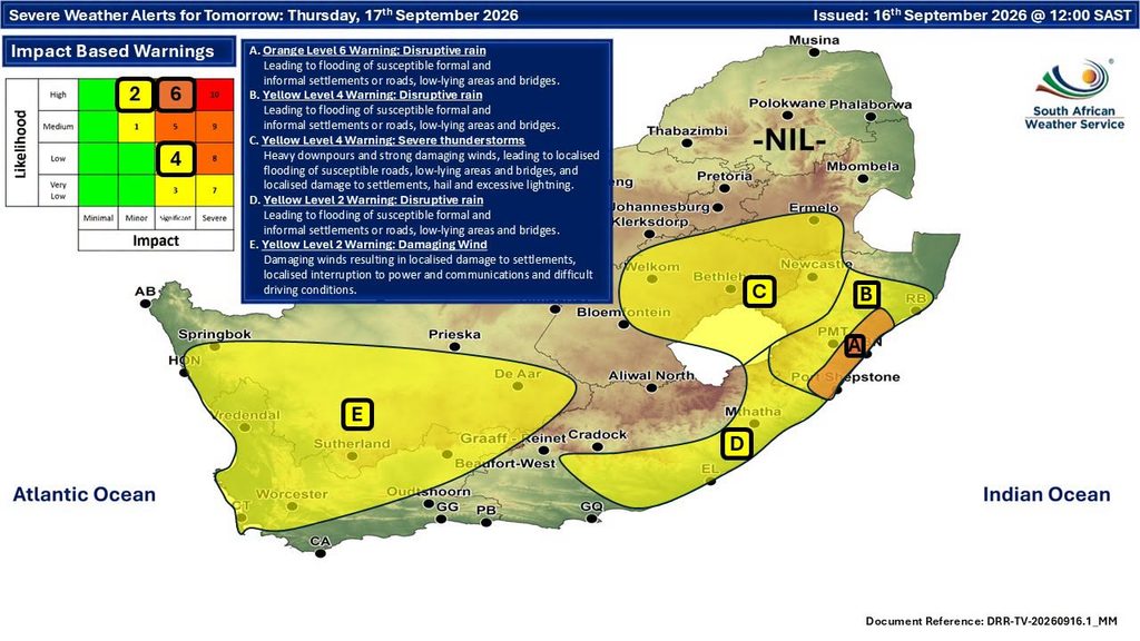
The most serious warning affects the south coast and adjacent interior of KwaZulu-Natal, where disruptive rain is expected until Friday.
Flooding of roads and formal and informal settlements is expected, with fast-flowing streams and deep water posing a danger to life.
The conditions could also result in the displacement of affected communities and loss of livelihoods and livestock.
Level 6 and Level 4 rain warnings for KwaZulu-Natal
An Orange Level 6 warning for disruptive rain is in place along the south coast and adjacent interior of KwaZulu-Natal until Friday.
A Yellow Level 4 warning for disruptive rain also affects the eastern and southern parts of the province until Friday.
Flooding of roads and settlements is expected, along with dangerous fast-flowing streams and deep water.
Affected communities could also face displacement and loss of livelihoods and livestock.
Severe thunderstorms forecast across three provinces
A Yellow Level 4 warning for severe thunderstorms has been issued for parts of the Free State, KwaZulu-Natal and Mpumalanga.
The affected areas include:
- Eastern and northern Free State
- North-western KwaZulu-Natal
- Southern Highveld of Mpumalanga
Heavy downpours are expected, with the possibility of damaging winds, excessive lightning and hail.
The storms could lead to injuries, danger to life and localised flooding.
@vox_weather_girls 🚨 HEAVY RAIN, FLOODING, SEVERE STORMS & SNOW ❄️⛈️🌧️ A BIG WEATHER DAY is expected across parts of South Africa on 17 SEPTEMBER, with VERY COLD, WET and WINDY conditions in the SOUTH and EAST. 🟠 An ORANGE LEVEL 6 warning is in place for parts of KZN, while SIGNIFICANT SNOW is expected over eastern Lesotho and the southern Drakensberg. Stay weather-aware and check the latest warnings. ⚠️ Vox Weather Forecast brought to you by Subaru Southern Africa 🚙 You can’t control the weather, but you can drive with confidence. #VoxWeather #AllWeatherConfidence #WeatherSA #HeavyRain #Flooding ♬ original sound – The Weather Girls
Eastern Cape faces disruptive rain
A Yellow Level 2 warning for disruptive rain is in place over the southern and extreme eastern parts of the Eastern Cape until Friday.
Localised flooding of settlements, roads and low-lying bridges is expected.
The weather could also result in localised disruptions to electricity supplies and communications.
Damaging winds forecast for Northern and Western Cape
A Yellow Level 2 warning for damaging winds affects the southern parts of the Northern Cape and northern parts of the Western Cape.
The winds could cause localised damage to settlements and interruptions to electricity and communications.
Difficult driving conditions are also expected.
Where could snow fall?
Very cold, wet and windy conditions are expected across a wide area until Friday.
Affected areas include the south-western parts of KwaZulu-Natal, southern Northern Cape, Eastern Cape and eastern and southern Free State.
In the Western Cape, the Cape Winelands, Central Karoo and Little Karoo districts are among the areas affected.
Light snowfall is possible over the high-lying areas of the Western Cape.
Extremely high fire danger in Limpopo
While several provinces face heavy rain and cold conditions, the western Bushveld of Limpopo has a different weather threat.
Extremely high fire danger is expected in the area.
With warnings ranging from dangerous flooding and severe thunderstorms to damaging winds, cold conditions and possible snow, residents in affected areas should remain aware of changing conditions through Friday.







Related Articles

Jill Scott heads to South Africa after Billboard R&B Hall of Fame honour
Jill Scott is heading to South Africa this November with another major...

Macklemore dropped from Ed Sheeran tour after ‘Free Palestine’ comments
Rapper Macklemore has been dropped from the remaining US dates of Ed...

Chronic stress may be affecting your blood sugar, weight and heart health
Stress might show up as poor sleep, irritability or feeling overwhelmed, but...



Herman Lensing serves up the tastes and memories of his Kalahari heritage
A cucumber mould salad can instantly transport you back to a family...
